Sorry, something wrong went with my last message - here is once again:
I have the following call-back code, which work fine:
INTEGER FUNCTION mapa ()
CHARACTER(len=30) cb_reason
CHARACTER(len=256) CLEARWIN_STRING@
CHARACTER(len=53) output_string(4)
character(len=53), parameter :: fmt(1:3)=(/'(F10.2,A2,1A,F11.2,2A)      ','(2X,A3,1X,F7.2,A2)          ','(a15)                       '/)
INTEGER*4 CLEARWIN_INFO@
INTEGER*4 xlp, ylp
REAL*8 xlr, ylr
cb_reason = clearwin_string@('callback_reason')
IF (cb_reason .eq. 'PLOT_ADJUST') THEN
i = COPY_GRAPHICS_REGION@(handle_internal_gr, 1, 1, gw, gh, handle_pl_MM, 1, 1, gw, gh, 13369376)
END IF

call yield_program_control@(Y_Temporarily) !aby nebola CPU zahltená iba touto kresliacou funkciou

        IF (cb_reason .eq. 'MOUSE_MOVE' ) THEN
                            i=COPY_GRAPHICS_REGION@(handle_pl_MM,1,1,gw,gh,handle_internal_gr,1,1,gw,gh,13369376)

IF (rb_show_grid_data.eq.1) then
ylp = CLEARWIN_INFO@('GRAPHICS_MOUSE_X') ; xlp = CLEARWIN_INFO@('GRAPHICS_MOUSE_Y')
i = GET_PLOT_DATA@(ylp,xlp,ylr,xlr)
write (output_string(1),fmt(1)) ylr,' m',',',xlr,' m'
ylr_i = nint(ylr); xlr_i = nint(xlr)
DO v = 1,L
IF (ylr_i == y_mm_i(v) .and. xlr_i == x_mm_i(v)) then
!!! write (output_string(4),fmt(3)) 'Bod: ', point_ID_MM
write (output_string(2),fmt(1)) y_mm(v),' m',',', x_mm(v),' m'
write (output_string(3),fmt(2))'H= ',H_MM(v),' m'
END IF
END DO
IF (rb_show_grid_data.eq.1) then
call draw_filled_rectangle@(ylp+10,xlp+10,ylp+160+10+10,xlp+20+35+10,rgb@(255,255,0))
!!! call draw_characters@(output_string(4),ylp+10,xlp+45,rgb@(255,0,0))
call draw_characters@(output_string(2),ylp+10,xlp+45,rgb@(255,0,0))
call draw_characters@(output_string(3),ylp+10,xlp+60,rgb@(0,0,255))
END IF
END IF
END IF
mapa = 2
END FUNCTION mapa
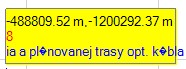
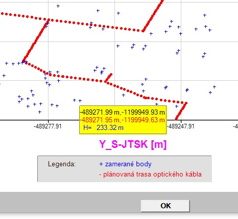
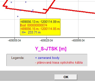
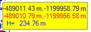
So, when I use the code above, I can see the data displayed correctly in
a yellow rectangle as can be see here:
Now, I want to let display the point names (point_ID) in the space
between pixel coordinates (black in the yellow box) and real geodetic coordinates from the field (in red in the yellow box), which should be assigned to real point ID for checking.
Have a look at the two commented out lines in the code above (with three exclamation marks). When I activate them and change the pixel dimensions of the yellow box to create a space for point names
appropriately, after compiling/linking (problem free), when I move over graphic area always getting the following error message:
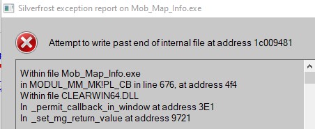 upload pix
What´s wrong with the activated code in previously commented out lines?
Thanks for some tips!
Martin